
檔案:Kosovo location map.svg

此 SVG 檔案的 PNG 預覽的大小:529 × 599 chhiong-su。 Khì-thâ kié-sak-thu: 212 × 240 chhiong-su | 424 × 480 chhiong-su | 678 × 768 chhiong-su | 904 × 1,024 chhiong-su | 1,808 × 2,048 chhiong-su | 1,015 × 1,150 chhiong-su.
Ngièn-pún tóng-on (SVG文件,尺寸:1,015×1,150像素,文件大細:149 KB)

|
The boundaries on this map show the de facto situation. This is just one of several different views on the subject (see COM:NPOV). |
Vùn-khien sot-mìn
| Mèu-sut |
Deutsch: Positionskarte des Kosovo
Quadratische Plattkarte, N-S-Streckung 140 %. Geographische Begrenzung der Karte:
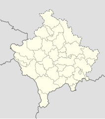
English: Location map of Kosovo
Equirectangular projection, N/S stretching 140 %. Geographic limits of the map:
|
| Ngit-khì | 01-08-2008 |
| Lòi-ngièn | own work, using United States National Imagery and Mapping Agency data |
| Chok-chá | NordNordWest |

|
|
Su-khièn
我,本作品的著作權持有者,決定用以下授權條款發佈本作品:

|
已授權您依據自由軟體基金會發行的無固定段落、封面文字和封底文字GNU自由文件授權條款1.2版或任意後續版本,對本檔進行複製、傳播和/或修改。該協議的副本列在GNU自由文件授權條款中。 |
此檔案採用創用CC 姓名標示-相同方式分享 3.0 未在地化版本授權條款。
- Ngì cho-tet chhṳ-yù:
- fûn-hióng – fu̍k-chṳ, fat-pu lâu chhòn-pô pún chok-phín
- chhùng-sîn siû-kói – chhóng-chok yên-yi̍t chok-phín
- 惟需遵照下列條件:
- 姓名標示 – 您必須指名出正確的製作者,和提供授權條款的連結,以及表示是否有對內容上做出變更。您可以用任何合理的方式來行動,但不得以任何方式表明授權條款是對您許可或是由您所使用。
- siông-thùng fông-sṳt fûn-hióng – 如果您利用本素材進行再混合、轉換或創作,您必須基於如同原先的相同或兼容的條款,來分布您的貢獻成品。
Ngì cho-tet sién-chet Ngì sî-yeu ke su-khièn thiàu-khóan.
Vùn-khien li̍t-sṳ́
Tiám-khim ngit-khì / sṳ̀-kiên lòi chhà-khon tông-sṳ̀ chhut-hien-ko ke vùn-khien.
| Ngit khì / Sṳ̀-kiên | Suk-lio̍k-thù | Vì-thu | Yung-fu | Yi-kien | |
|---|---|---|---|---|---|
| tông-chhièn | 2016年12月15日 (Si) 16:53 | | 1,015 × 1,150(149 KB) | NordNordWest | Reverted to version as of 10:16, 13 December 2016 (UTC); yeah, strange, try official maps; and now stop changing this map without a discussion _before_ |
| 2016年12月15日 (Si) 14:08 |  | 1,015 × 1,150(103 KB) | AceDouble | Reverted to version as of 22:04, 12 December 2016 (UTC) Strange boundaries!? that's a funny one. Check it here> http://www.balgoc.org.tr/harita/kosova.jpg | |
| 2016年12月13日 (Ngi) 10:16 |  | 1,015 × 1,150(149 KB) | NordNordWest | Reverted to version as of 13:03, 23 November 2009 (UTC); no need for different colours, strange boundaries | |
| 2016年12月12日 (Yit) 22:04 |  | 1,015 × 1,150(103 KB) | AceDouble | update | |
| 2009年11月23日 (Yit) 13:03 |  | 1,015 × 1,150(149 KB) | NordNordWest | update | |
| 2009年5月6日 (Sâm) 18:49 |  | 1,016 × 1,150(198 KB) | NordNordWest | more detailed | |
| 2008年8月29日 (Ńg) 08:04 |  | 1,016 × 1,150(78 KB) | NordNordWest | ||
| 2008年8月1日 (Ńg) 17:41 |  | 339 × 383(77 KB) | NordNordWest | {{Information |Description= {{de|Positionskarte des Kosovo}} Quadratische Plattkarte, N-S-Streckung 140 %. Geographische Begrenzung der Karte: * N: 43.4° N * S: 41.7° N * W: 19.8° O * O: 21.9° O {{en|Location map of [[:en:Kosovo|Kosovo] |
Vùn-khien yung-chhú
Mò ya̍p-mien lièn-chiap to pún vùn-khien.
Chhiòn-vet tóng-on sṳ́-yung chhong-khóng
Hâ-lie̍t khì-thâ Wiki chûng sṳ́-yung liá-chak tóng on:
- de.wikipedia.org ke sṳ́-yung chhong-khóng
- eo.wikipedia.org ke sṳ́-yung chhong-khóng
- es.wikipedia.org ke sṳ́-yung chhong-khóng
- fr.wikipedia.org ke sṳ́-yung chhong-khóng
- mt.wikipedia.org ke sṳ́-yung chhong-khóng
- pl.wikipedia.org ke sṳ́-yung chhong-khóng
- ru.wikipedia.org ke sṳ́-yung chhong-khóng
- sv.wikipedia.org ke sṳ́-yung chhong-khóng
- uk.wikipedia.org ke sṳ́-yung chhong-khóng