
檔案:Locator map of South Korea.svg

此 SVG 檔案的 PNG 預覽的大小:250 × 115 chhiong-su。 Khì-thâ kié-sak-thu: 320 × 147 chhiong-su | 640 × 294 chhiong-su | 1,024 × 471 chhiong-su | 1,280 × 589 chhiong-su | 2,560 × 1,178 chhiong-su.
Ngièn-pún tóng-on (SVG文件,尺寸:250×115像素,文件大細:1.18 MB)


Vùn-khien li̍t-sṳ́
Tiám-khim ngit-khì / sṳ̀-kiên lòi chhà-khon tông-sṳ̀ chhut-hien-ko ke vùn-khien.
| Ngit khì / Sṳ̀-kiên | Suk-lio̍k-thù | Vì-thu | Yung-fu | Yi-kien | |
|---|---|---|---|---|---|
| tông-chhièn | 2009年9月26日 (Liuk) 02:25 | | 250 × 115(1.18 MB) | Ksiom | Reverted to version as of 17:32, 10 July 2009 |
| 2009年9月13日 (Ngit) 03:36 |  | 1,000 × 460(1.45 MB) | Seb az86556 | color-scheme | |
| 2009年7月10日 (Ńg) 17:32 |  | 250 × 115(1.18 MB) | Ksiom | revised version | |
| 2008年10月30日 (Si) 13:36 |  | 250 × 115(1.34 MB) | Ksiom | rv (Ulleungdo and Dokdo are too small to be rendered in such a small map) | |
| 2008年10月30日 (Si) 12:12 |  | 250 × 115(1.37 MB) | 쿠도군 | ||
| 2008年10月19日 (Ngit) 20:13 |  | 250 × 115(1.34 MB) | Ksiom | ||
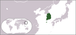
| 2008年10月19日 (Ngit) 17:27 |  | 250 × 189(229 KB) | Ksiom | {{Information |Description={{en|1=Locator map of South Korea.}} |Source=Own work by uploader |Author=Ksiom |Date=2008-10-20 |Permission= |other_versions= }} <!--{{ImageUpload|full}}--> |
Vùn-khien yung-chhú
Hâ poi ke 1-chak ya̍p-mien lièn-chiap to pún vùn-khien:
Chhiòn-vet tóng-on sṳ́-yung chhong-khóng
Hâ-lie̍t khì-thâ Wiki chûng sṳ́-yung liá-chak tóng on:
- ace.wikipedia.org ke sṳ́-yung chhong-khóng
- als.wikipedia.org ke sṳ́-yung chhong-khóng
- ang.wikipedia.org ke sṳ́-yung chhong-khóng
- ar.wikipedia.org ke sṳ́-yung chhong-khóng
- ast.wikipedia.org ke sṳ́-yung chhong-khóng
- as.wikipedia.org ke sṳ́-yung chhong-khóng
- az.wikipedia.org ke sṳ́-yung chhong-khóng
- ba.wikipedia.org ke sṳ́-yung chhong-khóng
- bg.wikipedia.org ke sṳ́-yung chhong-khóng
- blk.wiktionary.org ke sṳ́-yung chhong-khóng
- bn.wikipedia.org ke sṳ́-yung chhong-khóng
- bo.wikipedia.org ke sṳ́-yung chhong-khóng
- bpy.wikipedia.org ke sṳ́-yung chhong-khóng
- br.wikipedia.org ke sṳ́-yung chhong-khóng
- bs.wikipedia.org ke sṳ́-yung chhong-khóng
- ca.wikipedia.org ke sṳ́-yung chhong-khóng
- cdo.wikipedia.org ke sṳ́-yung chhong-khóng
- chr.wikipedia.org ke sṳ́-yung chhong-khóng
- csb.wikipedia.org ke sṳ́-yung chhong-khóng
- cy.wikipedia.org ke sṳ́-yung chhong-khóng
- de.wikipedia.org ke sṳ́-yung chhong-khóng
- de.wiktionary.org ke sṳ́-yung chhong-khóng
- dsb.wikipedia.org ke sṳ́-yung chhong-khóng
- dv.wikipedia.org ke sṳ́-yung chhong-khóng
- dz.wikipedia.org ke sṳ́-yung chhong-khóng
- en.wikipedia.org ke sṳ́-yung chhong-khóng
- en.wiktionary.org ke sṳ́-yung chhong-khóng
- es.wikipedia.org ke sṳ́-yung chhong-khóng
Kiám-sṳ liá vùn-khien ke kiên-tô chhiòn-vet sṳ́-yung chhong-khóng.