
檔案:China edcp location map.svg

此 SVG 檔案的 PNG 預覽的大小:512 × 408 chhiong-su。 Khì-thâ kié-sak-thu: 301 × 240 chhiong-su | 602 × 480 chhiong-su | 964 × 768 chhiong-su | 1,280 × 1,020 chhiong-su | 2,560 × 2,040 chhiong-su.
Ngièn-pún tóng-on (SVG文件,尺寸:512×408像素,文件大細:2.56 MB)
Vùn-khien sot-mìn
| Mèu-sut |
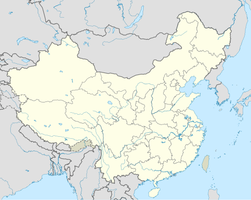
English: Location map of China.
EquiDistantConicProjection : Central parallel :
Central meridian :
Standard parallels:
Latitudes on the central meridian :
|
| Ngit-khì | |
| Lòi-ngièn | Chhṳ-kâ ke chok-phín |
| Chok-chá | Uwe Dedering |
| 其他版本 |
此檔案衍生的作品:
|
| SVG開發 |

Su-khièn
我,本作品的著作權持有者,決定用以下授權條款發佈本作品:
此檔案採用創用CC 姓名標示-相同方式分享 3.0 未在地化版本授權條款。
- Ngì cho-tet chhṳ-yù:
- fûn-hióng – fu̍k-chṳ, fat-pu lâu chhòn-pô pún chok-phín
- chhùng-sîn siû-kói – chhóng-chok yên-yi̍t chok-phín
- 惟需遵照下列條件:
- 姓名標示 – 您必須指名出正確的製作者,和提供授權條款的連結,以及表示是否有對內容上做出變更。您可以用任何合理的方式來行動,但不得以任何方式表明授權條款是對您許可或是由您所使用。
- siông-thùng fông-sṳt fûn-hióng – 如果您利用本素材進行再混合、轉換或創作,您必須基於如同原先的相同或兼容的條款,來分布您的貢獻成品。

|
已授權您依據自由軟體基金會發行的無固定段落、封面文字和封底文字GNU自由文件授權條款1.2版或任意後續版本,對本檔進行複製、傳播和/或修改。該協議的副本列在GNU自由文件授權條款中。 |
Ngì cho-tet sién-chet Ngì sî-yeu ke su-khièn thiàu-khóan.
Vùn-khien li̍t-sṳ́
Tiám-khim ngit-khì / sṳ̀-kiên lòi chhà-khon tông-sṳ̀ chhut-hien-ko ke vùn-khien.
| Ngit khì / Sṳ̀-kiên | Suk-lio̍k-thù | Vì-thu | Yung-fu | Yi-kien | |
|---|---|---|---|---|---|
| tông-chhièn | 2021年12月13日 (Yit) 04:10 | | 512 × 408(2.56 MB) | Maanshen | Update borders and land reclamation. |
| 2021年10月31日 (Ngit) 02:44 |  | 512 × 408(2.54 MB) | Not logging in | Fix colored path shown as land in XInjiang and Gansu. | |
| 2021年10月31日 (Ngit) 02:41 |  | 512 × 408(2.54 MB) | Not logging in | FIx | |
| 2021年10月31日 (Ngit) 02:35 |  | 512 × 408(2.54 MB) | Not logging in | Corrected borders for Xinjiang, Qinghai, and Gansu provincial borders per request, see NordNordWest's talk page | |
| 2021年3月29日 (Yit) 12:32 |  | 512 × 408(2.36 MB) | 瑞丽江的河水 | Reverted to version as of 09:13, 22 February 2021 (UTC), disputed area, special color | |
| 2021年3月29日 (Yit) 07:40 |  | 1,181 × 940(4.07 MB) | Turbo Slayer 2021 | Reverted to version as of 02:23, 28 March 2021 (UTC)Firstly, Taiwan is not a part of China cause the Government of Taiwan is Republic of China. Southern Tibet is a part of India not China. That's all | |
| 2021年3月28日 (Ngit) 14:08 |  | 512 × 408(2.36 MB) | 瑞丽江的河水 | Reverted to version as of 09:13, 22 February 2021 (UTC) | |
| 2021年3月28日 (Ngit) 02:23 |  | 1,181 × 940(4.07 MB) | Turbo Slayer 2021 | Reverted to version as of 20:14, 31 August 2011 (UTC) | |
| 2021年2月22日 (Yit) 09:13 |  | 512 × 408(2.36 MB) | DokiDonkey | Fix | |
| 2021年2月19日 (Ńg) 09:23 |  | 512 × 408(2.34 MB) | DokiDonkey | Change Trans-Karakoram Tract |
Vùn-khien yung-chhú
Hâ poi ke 2-chak ya̍p-mien lièn-chiap to pún vùn-khien:
Chhiòn-vet tóng-on sṳ́-yung chhong-khóng
Hâ-lie̍t khì-thâ Wiki chûng sṳ́-yung liá-chak tóng on:
- ace.wikipedia.org ke sṳ́-yung chhong-khóng
- af.wikipedia.org ke sṳ́-yung chhong-khóng
- Nanjing
- Groot Muur van China
- Sjabloon:Liggingkaart Volksrepubliek China
- Shangqiu
- Dongguan
- Wenzhou
- Zibo
- Suzhou, Jiangsu
- Kaifeng
- Qingdao
- Xiamen
- Shantou
- Wuxi
- Quanzhou
- Shijiazhuang
- Changsha
- Hefei
- Kunming
- Tangshan
- Ningbo
- Fuzhou
- Changzhou
- Taizhou, Zhejiang
- Ürümqi
- Guiyang
- Xuzhou
- Nanchang
- Lanzhou
- Anshan
- Yangzhou
- Nantong
- Hohhot
- Jilin (stad)
- Huainan
- Linyi
- Xiangtan
- Huizhou
- Baotou
- Nanyang
- Baoding
- Liuzhou
- Tai'an
- Fuyang
- Jiangmen
- Yinchuan
- Weifang
- Zhuhai
- Huangshi
Kiám-sṳ liá vùn-khien ke kiên-tô chhiòn-vet sṳ́-yung chhong-khóng.