
檔案:Isle of Anglesey UK location map.svg

此 SVG 檔案的 PNG 預覽的大小:681 × 600 chhiong-su。 Khì-thâ kié-sak-thu: 273 × 240 chhiong-su | 545 × 480 chhiong-su | 872 × 768 chhiong-su | 1,163 × 1,024 chhiong-su | 2,325 × 2,048 chhiong-su | 1,425 × 1,255 chhiong-su.
Ngièn-pún tóng-on (SVG文件,尺寸:1,425×1,255像素,文件大細:793 KB)
| Mèu-sut |
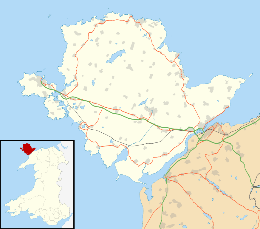
Blank map of the Anglesey, UK with the following information shown:
Equirectangular map projection on WGS 84 datum, with N/S stretched 165% Geographic limits:
|
| Ngit-khì | |
| Lòi-ngièn |
|
| Chok-chá | Nilfanion, created using Ordnance Survey data |
| Khièn-han: (Chhùng-yung liá-chak tóng-on) |
此檔案採用創用CC 姓名標示-相同方式分享 3.0 未在地化版本授權條款。 姓名標示: Contains Ordnance Survey data © Crown copyright and database right
|
| 其他版本 | File:Isle of Anglesey UK map.svg - Blank map |
Vùn-khien li̍t-sṳ́
Tiám-khim ngit-khì / sṳ̀-kiên lòi chhà-khon tông-sṳ̀ chhut-hien-ko ke vùn-khien.
| Ngit khì / Sṳ̀-kiên | Suk-lio̍k-thù | Vì-thu | Yung-fu | Yi-kien | |
|---|---|---|---|---|---|
| tông-chhièn | 2010年9月26日 (Ngit) 19:34 | | 1,425 × 1,255(793 KB) | Nilfanion | {{Information |Description=Blank map of the Anglesey, UK with the following information shown: *Administrative borders *Coastline, lakes and rivers *Roads and railways *Urban areas Equirectangular map projection on WGS 84 datum, wi |
Vùn-khien yung-chhú
Hâ poi ke 1-chak ya̍p-mien lièn-chiap to pún vùn-khien:
Chhiòn-vet tóng-on sṳ́-yung chhong-khóng
Hâ-lie̍t khì-thâ Wiki chûng sṳ́-yung liá-chak tóng on:
- af.wikipedia.org ke sṳ́-yung chhong-khóng
- ar.wikipedia.org ke sṳ́-yung chhong-khóng
- bn.wikipedia.org ke sṳ́-yung chhong-khóng
- ceb.wikipedia.org ke sṳ́-yung chhong-khóng
- cy.wikipedia.org ke sṳ́-yung chhong-khóng
- da.wikipedia.org ke sṳ́-yung chhong-khóng
- el.wikipedia.org ke sṳ́-yung chhong-khóng
- en.wikipedia.org ke sṳ́-yung chhong-khóng
- List of monastic houses in Wales
- Holyhead
- Beaumaris Castle
- Llangefni
- Amlwch
- Cemaes
- Newborough, Anglesey
- Beaumaris
- Menai Bridge
- Caernarfon Bay
- RAF Valley
- Bodedern
- Middle Mouse
- West Mouse
- RAF Mona
- South Stack
- Aberffraw
- Pentraeth
- Ynys Llanddwyn
- Llannerch-y-medd
- Llaingoch
- Llandegfan
- Benllech
- Moelfre, Anglesey
- Llangoed
- Red Wharf Bay
- Abermenai Point
- Cemlyn
- Fedw Fawr
- Tŷ Croes
- Ynys Feurig, Cemlyn Bay and The Skerries Special Protection Area
- Ynys Benlas
- South Stack Cliffs RSPB reserve
- Aber Alaw
- Rhosneigr
Kiám-sṳ liá vùn-khien ke kiên-tô chhiòn-vet sṳ́-yung chhong-khóng.