
檔案:Západní Sibiř.png
Yi-lám thai séu: 800 × 572 chhiong-su. Khì-thâ kié-sak-thu: 320 × 229 chhiong-su | 640 × 457 chhiong-su | 946 × 676 chhiong-su.
Ngièn-pún tóng-on (946 × 676 chhiong-su, vùn-khien thai-séu: 785 KB, MIME lui-hîn: image/png)
| Mèu-sut |
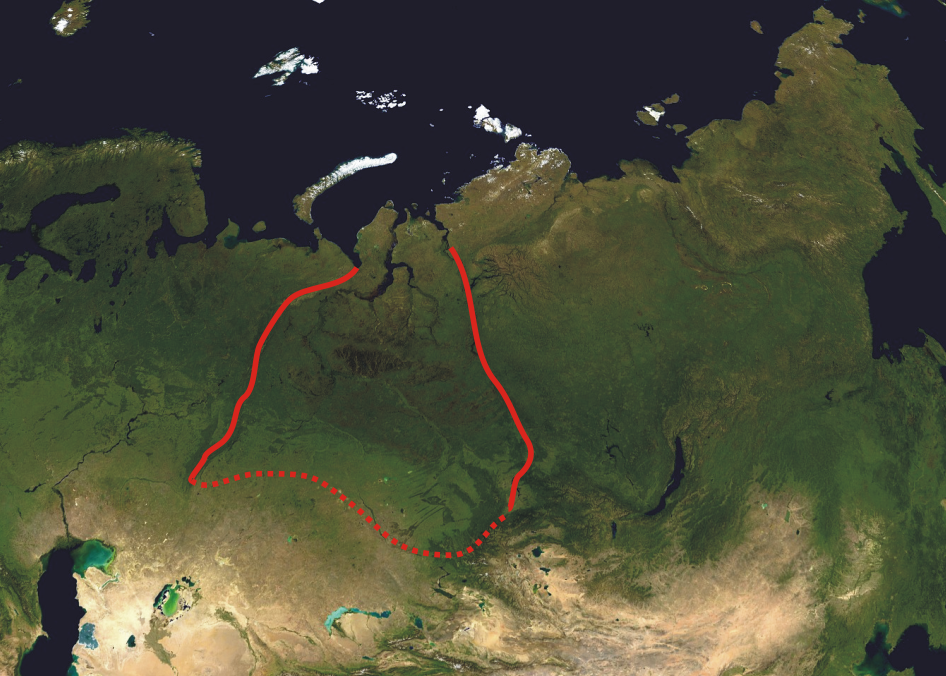
A composed satellite photograph of Asia in orthographic projection This is NASA "Blue Marble" image applied as a texture on a sphere using Art of Illusion program. The observer is centered at (40° N, 85° E), at Moon distance above the Earth. This modification describes boundaries of West Siberian Plain (red line). |
| Ngit-khì | (UTC) |
| Lòi-ngièn | |
| Chok-chá |
|
| 這是一張修飾過的圖片,即本圖片是用軟體修改過後的版本。原版圖片來源:Asia satellite orthographic.jpg。
|
| 本作品由NASA創作,屬於公有領域。根據NASA的版權政策:“NASA的創作除非另有聲明否則不受版權保護。”(參見:Template:PD-USGov/zh,NASA版權政策或JPL圖像使用政策) | ||
 |
警告:
|
原始上傳日誌
This image is a derivative work of the following images:
- File:Asia_satellite_orthographic.jpg licensed with PD-USGov-NASA
- 2005-04-19T11:33:19Z Ghalas 1887x1962 (875143 Bytes) A composed satellite photograph of [[:en:Asia|Asia]] in [[:en:Orthographic_projection_(cartography)|orthographic projection]] This is NASA [http://visibleearth.nasa.gov/view_rec.php?vev1id=11656 "Blue Marble"] image applied
Uploaded with derivativeFX
Vùn-khien li̍t-sṳ́
Tiám-khim ngit-khì / sṳ̀-kiên lòi chhà-khon tông-sṳ̀ chhut-hien-ko ke vùn-khien.
| Ngit khì / Sṳ̀-kiên | Suk-lio̍k-thù | Vì-thu | Yung-fu | Yi-kien | |
|---|---|---|---|---|---|
| tông-chhièn | 2010年4月4日 (Ngit) 18:41 | | 946 × 676(785 KB) | Hanzs~commonswiki | {{Information |Description=A composed satellite photograph of Asia in orthographic projection This is NASA [http://visibleearth.nasa.gov/view_rec.php?vev1id=11656 "Blue Marble"] image applied as |
Vùn-khien yung-chhú
Hâ poi ke 1-chak ya̍p-mien lièn-chiap to pún vùn-khien:
Chhiòn-vet tóng-on sṳ́-yung chhong-khóng
Hâ-lie̍t khì-thâ Wiki chûng sṳ́-yung liá-chak tóng on:
- ar.wikipedia.org ke sṳ́-yung chhong-khóng
- bg.wikipedia.org ke sṳ́-yung chhong-khóng
- ca.wikipedia.org ke sṳ́-yung chhong-khóng
- ckb.wikipedia.org ke sṳ́-yung chhong-khóng
- cs.wikipedia.org ke sṳ́-yung chhong-khóng
- cy.wikipedia.org ke sṳ́-yung chhong-khóng
- el.wikipedia.org ke sṳ́-yung chhong-khóng
- en.wikipedia.org ke sṳ́-yung chhong-khóng
- fa.wikipedia.org ke sṳ́-yung chhong-khóng
- fi.wikipedia.org ke sṳ́-yung chhong-khóng
- fr.wikipedia.org ke sṳ́-yung chhong-khóng
- gl.wikipedia.org ke sṳ́-yung chhong-khóng
- hr.wikipedia.org ke sṳ́-yung chhong-khóng
- hy.wikipedia.org ke sṳ́-yung chhong-khóng
- ja.wikipedia.org ke sṳ́-yung chhong-khóng
- kk.wikipedia.org ke sṳ́-yung chhong-khóng
- ky.wikipedia.org ke sṳ́-yung chhong-khóng
- ml.wikipedia.org ke sṳ́-yung chhong-khóng
- ru.wikipedia.org ke sṳ́-yung chhong-khóng
- sk.wikipedia.org ke sṳ́-yung chhong-khóng
- sr.wikipedia.org ke sṳ́-yung chhong-khóng
- sw.wikipedia.org ke sṳ́-yung chhong-khóng
- ta.wikipedia.org ke sṳ́-yung chhong-khóng
- uk.wikipedia.org ke sṳ́-yung chhong-khóng
- vi.wikipedia.org ke sṳ́-yung chhong-khóng
- www.wikidata.org ke sṳ́-yung chhong-khóng
- zh.wikipedia.org ke sṳ́-yung chhong-khóng